

David R. Foster’s new book, A Meeting of Land and Sea: Nature and the Future of Martha’s Vineyard, weaves dynamic tales of geology, ecology, history and culture into a vast Vineyard story.
A MEETING OF LAND AND SEA: Nature and the Future of Martha’s Vineyard . By David R. Foster. Illustrations by Brian R. Hall. New Haven and London: Yale University Press. 2017. 336 pages. $40.00, hardback. In bookstores soon.
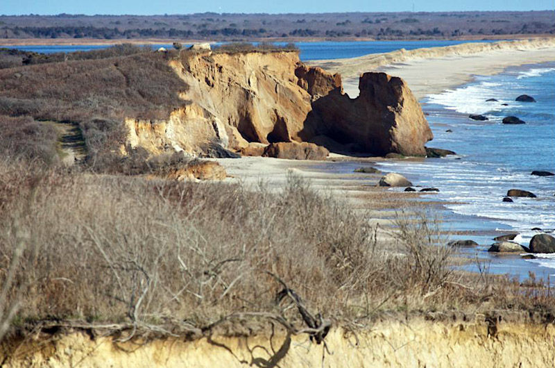
Thanks to a glacier, Martha’s Vineyard was the last piece of ground to be created in all of New England. Thanks to the rising sea, it will be the first to go.
Setting aside location and beauty, it’s probably fair to ask whether it really matters what happens to the Island, given that the interval between the beginning and the end will probably clock in at something less than 30,000 years, a fraction of a second in geological time.
As if in answer, David R. Foster offers a new book called A Meeting of Land and Sea: Nature and the Future of Martha’s Vineyard. It is an incomparable work, weaving dynamic tales of geology, ecology, history and culture into a vast Vineyard story, one without rival anywhere. This includes our nearest Cape and Island neighbors, whose topography and therefore record of ecology and land use are nowhere near as varied.
Mr. Foster is a part-time resident of West Tisbury and director of Harvard Forest, a research center associated with the university and based in Petersham. An ecologist known nationally for his work on woodlands, his Vineyard interests extend from the morainal hills to the inland ponds and outward to the shoreline. With the help of his own photographs and a gallery of revelatory maps and charts, in the book he explains how aboriginal and colonial settlers made use of everything on the Island and in the waters around it.
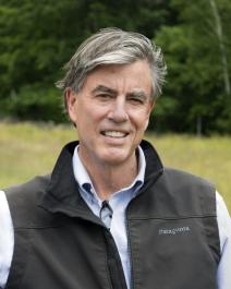
Author David Foster is the director of Harvard Forest.
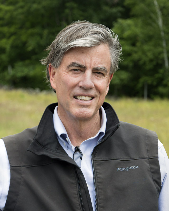
Author David Foster is the director of Harvard Forest.
But why a book so broad in scope and yet so narrowly focused on such a small offshore place?
Early on, Mr. Foster makes a startling case, declaring that New England in general and the Vineyard in particular lead the country and even the globe in efforts to save, restore and protect the land, and that the Island can do even more by living actively, companionably and even profitably upon it. With the rest of the Northeast, the Island is uniquely positioned to show the world ways by which it might reverse course ecologically and save itself from . . . well, itself.
The Vineyard has so far conserved fully 40 per cent of its acreage from development, and there are opportunities to save much more. Placed where it is, and managed by devoted inhabitants, the Island can patiently conduct long-term, self-contained experiments in land use and conservation that the rest of the country and planet may one day benefit from, Mr. Foster writes.
The Island has already shown how forests — and the diversity of species they support — can recover after generations of clearing and grazing, he says. Conversely (and perhaps surprisingly, given his record as a woodland scientist) he argues for more farming, given that agriculture can help to keep old pasturelands and ocean views open, working people employed, consumers healthy and the economy diverse. Equally intriguing, he’s a big fan of homegrown timber businesses and leaving uprooted and fractured forests as they are after hurricanes waylay them.
The book carries forward the coastal and Island work of previous authors (among them These Fragile Outposts by Barbara Blau Chamberlain and The Geologic Story, focused on Cape Cod and the Islands, by Robert N. Oldale). But it also stands apart and alone, like the Island so dramatically revealed in its stories, images and charts. It’s an encyclopedia written like an adventure story and illustrated like an art book.
Some of Mr. Foster’s thinking may prove controversial. In essays, talks, and during Island nature walks, he offers theories that occasionally contend with fragmented historical records and current practice.
The reader who accepts his ideas may come to question the use of controlled burns to open and revive the landscape in springtime. (The author generally prefers grazing.) He may wind up doubting the Island nativity of the lost and lamented heath hen, which went extinct here in 1932. (Mr. Foster wonders whether it makes sense to resurrect the species through genetic engineering, an effort now underway.) He may even start to ask disconcerting questions about the legendary first Thanksgiving story over in Plymouth. (Wampanoags did not farm or grow corn until after the colonists arrived, Mr. Foster says.)
And there is one more thing, every bit as compelling as the book itself: a website that offers a wonderful new interactive map of Martha’s Vineyard, based on the work of the great cartographer Henry L. Whiting of West Tisbury between 1845 and 1860.
With a slider, it’s possible to shift back and forth between the beautiful, breathtakingly precise 150-year-old Whiting map and one of four views of the Island today. As the bar moves left and right, towns grow and shrink, shorelines advance and retreat, roads appear or fade into ancient ways, woodlands become farms and farms vanish into forests. With a phone, it’s even possible to zero in on the very ground where you stand and uncover the changes there. (The map, created by Mr. Foster and Jenny Hobson of Harvard Forest, can be found online at mvlandandsea.com/maps.)
A final note and disclosure: I supplied a few pages of historical data to Mr. Foster’s research. I did so with the hope that it would help to bring about something all students of Island history have long hoped for — a geological, natural and cultural story of the Vineyard from the beginning to today, offering with it wise counsel about what we and the world might do with the knowledge and opportunities we now have.
A Meeting of Land and Sea, in company with the interactive map, delivers that story and that counsel in unprecedented, exceptional and immediately indispensable ways.
David Foster will speak on Saturday, August 5 at 1:10 p.m. at the Harbor View Hotel, and on Sunday, August 6 at 12:30 p.m. at the Chilmark Community Center.
Comments
the inter active map has been
ed grazda chilmarkthe inter active map has been live for at least 6 months
How much land is to much to
Bob EdgartownHow much land is to much to save for preservation of Martha's Vineyard? Where do people who need housing fit in? How much land do people get?
The people in many cases, esp
Nancy Dole West TisburyThe people in many cases, esp via Land Bank properties, get the great gift of natural beauty that they can freely enjoy: woods, beaches, fields, every plant and creature that lives in them. Natural wonders that would be denied to most of us if the land were in private hands. I understand many individuals still need homes, that is true in many places, not just here. Most of us have struggled with that in our lives here. But here, more than many other places, we have so much, thanks to conservation, to share together. We can address the lack of affordable housing as a community without lessening our interest in protecting the island through conservation. The more conservation the better, for all of us.
Preservation land is not what
Jay Lagemann ChilmarkPreservation land is not what is driving up the price on housing on Martha's Vineyard. It is rich people.
Bob, like my father once said
Vineyarder OB NYCBob, like my father once said, life's not fair. Preservation trumps affordable housing.
I am so tired of reading
A long time resident EdgartownI am so tired of reading about the need for housing. When does is end? Do we provide housing for the great great grand kids of those we freely house now? I am much more concerned about over population than housing. The community does not have responsibility to house anyone. If it is to expensive here, move on. I surely would, as opposed to begging my neighbors to house me. In fact, there is much more opportunity off Island for you and your family.
Wow! "Let them eat cake",
Another long time resident ChappaquiddickWow! "Let them eat cake", right? Let's see how you feel about providing affordable housing when your house catches fire, and there are no firemen; or you need medical treatment and there are no nurses. No plumbers, no police officers, no electricians, no teachers....Get it?
I spent a lot of time in
Mike Corbett Jonesport, MaineI spent a lot of time in housing provided by the government. A few years of that time was spent on the Vineyard. In West Chop. At the lighthouse. Where I started my day every day. I then went on the road to Menemsha to check on the occupants of government housing there. All of this "housing" was provided for "free"....all we had to do was be ready to assist people in their waterborne emergencies. Very often the emergency put us in dire straits ourselves.
It would have been much nicer if we could have put the TV on pause long enough to get our beer and cigarettes by simply producing a government issued credit card then return to our viewing after turning up the thermostat to 75 degrees.
I hate to quibble, but the
Jay Lagemann ChilmarkI hate to quibble, but the highest point on Nantucket is 111 feet above the present sea level while Peaked Hill in Chilmark is exactly 200 feet higher. So I'm pretty sure Nantucket will be washed into the ocean long before Martha's Vineyard.
Technically speaking, the
Tom Dunlop EdgartownTechnically speaking, the reviewer's (meaning my) error: Yes, Nantucket will probably become shoal water before the Vineyard, whose north shore highlands may wind up becoming a new chain of islands, like the Elizabeths, before we'll all through. I meant it more metaphorically, as in all of us out here in southeastern New England. But thanks for the astute observation. Specificity noted.
Add new comment