

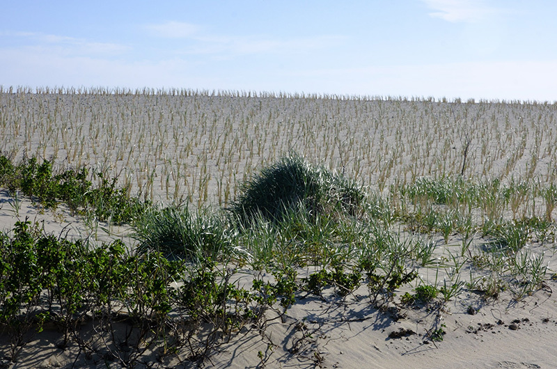
Gusty winds blew across the Atlantic ocean Tuesday evening when some 20 Islanders gathered at the left fork of South Beach. A newly restored dune about 14 feet high obscured any view of the ocean from the road.
Gusty winds blew across the Atlantic ocean Tuesday evening when some 20 Islanders gathered at the left fork of South Beach. A newly restored dune about 14 feet high obscured any view of the ocean from the road. A maze of tawny beach grass poked out along the dune’s surface, swaying in the wind.
“Before this project was done, everything here, for lack of a better word, was flatter than a pancake,” said Jane Varkonda, the Edgartown conservation agent.
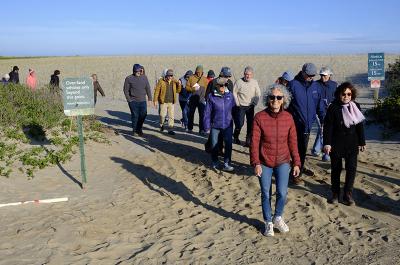
Group tour Tuesday was part of climate action week, which ends Saturday.
Group tour Tuesday was part of climate action week, which ends Saturday.
The restored dune stretches across the invisible line demarcating South Beach from Norton Point, which is managed by the Trustees of Reservations. Edgartown partnered with the Trustees for the dune restoration project. Ms. Varkonda and Russ Hopping, an ecologist from the Trustees, led a guided tour of the area as part of the climate action week that runs through Saturday.
The 400 feet of new coastal dune is meant to protect against ocean overwash, Ms. Varkonda said. In 2018 severe storms accelerated the erosion process and since then ocean water has repeatedly toppled the dune leaving abutting infrastructure vulnerable.
The town used its dredge to bring sand from Katama Bay to restore the dune, Ms. Varkonda said, a fact that won the endorsement of the group.
“Oh, that’s neat!” one man said.
“It doesn’t get more local than that,” another added.
This summer the main beach entrance will not be open because there is a roughly four-foot drop between the dune and the beach, Ms. Varkonda explained. Fencing climbs up the dune and wraps into a cul-de-sac to prohibit access. A sign reads “Caution: severe beach erosion, proceed with care” inside the fencing.
“There might just be a lot more people down at the right fork this year,” Ms. Varokonda said.
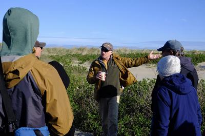
Trustees of Reservations ecologist Russ Hopping.

Trustees of Reservations ecologist Russ Hopping.
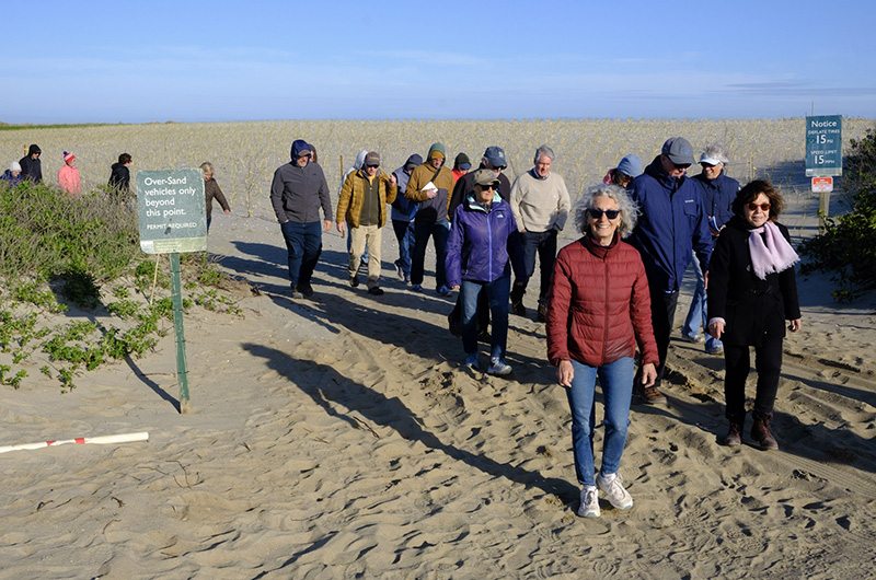
The group trudged down the oversand vehicle path, which was moved back in order to make space for the new dune, Mr. Hopping said. Tire marks, foot and paw prints dotted the new path.
A woman noted that the path seemed too narrow for two-way traffic. Mr. Hopping concurred, but pointed to a number of turnouts for drivers to yield to one another.
The idea was for traffic to go out on the path and for drivers to come back in on the beach, Ms. Varkonda said. But that plan is in flux because the shoreline itself is constantly in flux, making it uncertain if there will be any beach to drive on.
The ever-changing shoreline also creates uncertainty over where the new gatehouse will go, Ms. Varkonda said. If it looks like there will be no beach, then the gatehouse will go on the pavement near the bathhouses.
“Things are changing really fast here and there’s only so much we can do,” Mr. Hopping said.
After scrambling off the path to make way for an oncoming vehicle, the group ended the tour by going on to the beach for a view of the choppy water. In response to a question about using fencing to help fortify the dune, Mr. Hopping said it was a possibility, but once again he pointed to the fickle nature of the environment.
“We’re going to have to be a little nimble here and be able to monitor the beach, look for where things may be deteriorating and think about low impact, but impactful ways that we can try to prevent a breach or some major erosion,” the ecologist said.
Comments
Here we go again. Lets make
katamapoint EdgartownHere we go again. Lets make sure that vehicles can access the beach, but block off the walk in main entrance. So now we have no beach but plenty of vehicle access. What is it that gives the trustees so much influence over this area? Shame on all concerned for ruining what once was a beautiful area.
Add new comment