

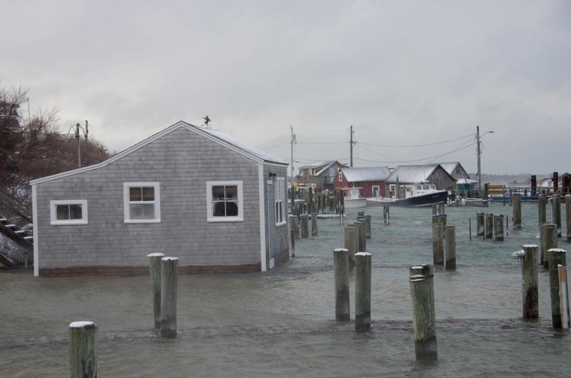
New FEMA maps mean many home and business owners in the commonwealth must either pay millions of dollars for renovations or shell out for flood insurance premiums that reach beyond $30,000 a year.
The Federal Emergency Management Agency has released its new flood zone maps for communities across the country, including Massachusetts.
Today, with the new maps, many home and business owners throughout the commonwealth must either pay millions of dollars for additional renovations to raise their building even higher or pay flood insurance premiums — upwards of $30,000 a year. My office has received numerous calls from residents who are afraid they may lose their homes because their flood insurance premiums have increased by tens of thousands of dollars. These are just a few of the challenges associated with the new flood insurance program.
The maps and accompanying flood-insurance premiums are not only severely affecting homes — most of which are primary residences — and residents’ finances throughout the eastern part of the commonwealth. They also have a negative impact on small businesses, the real estate market and the entire local economy.
The challenge is not just about increased premiums coming at a time when many residents are still trying to make ends meet. Homes and businesses that were not in a flood zone under the old system have since been included; many of these structures are miles from the shore. Worse, these maps are not correct for our area, thus subjecting homeowners and small business owners to exorbitant flood insurance premiums when the science they are based upon is inappropriate for our state.
Last month I requested an independent review of FEMA’s flood maps from an objective source. Dr. Brian Howes, a scientist from the University of Massachusetts at Dartmouth’s School of Marine Science and Technology, and John Ramsey, an engineer from Applied Coastal Research and Engineering in Woods Hole, agreed to conduct the review and used the town of Marshfield as a test case.
Their findings indicate that FEMA applied an inappropriate methodology for our region when establishing the new flood zone maps. The methodology employed used the Pacific coast model, which does not truly reflect flooding patterns found on the Atlantic coastline in New England. Flooding on the Pacific coastline originates from the continuous nature of the waves. On the other hand, flooding on the Atlantic Coast is most often the result of storms and surges.
While the difference between the Pacific and Atlantic Coast’s flood patterns may not seem so important, they are critical to establishing the correct perimeters for flood zones and the premiums associated with them. Since the increased flood insurance premiums were announced, many people have been discussing this challenge in terms of an affordability issue. With the release of findings by Brian Howes and John Ramsey, we have the first concrete evidence that the science behind these maps is not correct for our region.
FEMA needs to delay implementation of their new flood zone maps until the appropriate methodology for our region is applied. Massachusetts residents shouldn’t be at risk of losing their homes because of a program that is designed to protect them.
Rep. William Keating represents Massachusetts in the ninth congressional district. A version of this piece was published in the Boston Globe on Jan. 11.
Comments
I would urge Mr. Keating to
Dan ObI would urge Mr. Keating to use his independent review to not point fingers at FEMA, but rather establish his own estimated perimeters for our region. I think he would find that the true numbers are much higher, and that many more residents are at risk.
By using the Pacific flood pattern model, the new FEMA maps are conservative numbers at best. Here on the Atlantic, we not only have strong storms that are raising the flood zones. The Atlantic seaboard is sinking, as proven by many recent studies. The Gulf Stream is slowing down, as proven by many studies. The Atlantic seaboards ocean rises faster than any other coastline in America.
If FEMA were to incorporate these facts into the new flood maps, which would correctly articulate the reasons for the rising flood zones, will not only ensure that the current flood maps are accurate, but would most likely expand the zones to include many more residents.
You'll have a lot more angry residents on your hands then.
The numbers are not pretty, no matter how we look at it.
I know Mr. Keating is trying
Richard Toole Oak BluffsI know Mr. Keating is trying to look out for the people he represents. In doing so I hope he thinks about all of us. It seems that because of a lack of information and some denial, fueled by subsidized flood insurance and FEMA's deep pockets development has occurred in places it probably should not have.
Now after massive financial loss from recent storms FEMA is trying to present the reality of our situation and prepare for what might be next. Perhaps they don't have it exactly right but at least this is a start. This means planning more carefully where new development is allowed and where and when existing development will be able retreat to. Those who choose to remain in harm's way should be expected to pay appropriate insurance premiums. MV has been very lucky in avoiding most of the damaging weather related events of the past few years. I hope it doesn't take a devastating direct hit to spur us on to do the planning and make the changes we need to make now.
Add new comment